My daughter tells me I have fallen down in my responsibilities to update the blog. Truth is, I’d rather not post blah, blah, blah than bore you all. With that said, I think today’s post will make up for my lack of posting.
Fall is only a day or two away, but in the Rockies, fall has arrived. Based upon a Facebook post we saw earlier in the week from Breckenridge, my bride and I took a 350 mile or so adventure to see if the picture was true or not.
I wanted to get a good sampling of colors if possible, as well as see what elevation fall was or had set in. We rode south on Hwy 115 to Canon City where we picked up Hwy 50 west. I knew we wouldn’t see what we were after on this course, but if we wanted to start from a lower elevation, this is the way we needed to go.
The weather wasn’t in our favor, but we did get lucky. The weatherman said a cold front was entering the state, which would bring cooler temperatures and rain throughout the weekend and into the first part of the week. Mentally, we had prepared ourselves for whatever we might encounter.
Once we got past Canon City, we rode the winding road into and through a continuous gorge with a river running to our right. We were pretty surprised to see the water levels at such a high height, but we had received a lot of rain over the course of the summer. When we came out of the gorge and into more open area, we knew we were close to Salida where we would be turning to the north.
Just past Salida, we turned onto Hwy 285. Up to this point, we had not seen a change in colors within our immediate elevation, but we had seen colors up on the mountains to the west. This would change within the next 20 miles. Hwy 285 and Hwy 24 merge about 20 miles north of the turn we made. Where they merge, Hwy 285 goes off to the east (285 and 24 are on in the same in that direction) and Hwy 24 leads to the north. It was in this general area that we began to notice, ever so slightly, fall like colors, but we still had not found what we were looking for.
5 miles or so up the road from where the two Hwys merge is Buena Vista. I hadn’t ever considered it before, but I think Buena Vista might be a marker for “the” spot to start your fall color search because the elevation starts to climb there but you don’t notice it. Plus, the turn off to Cottonwood Pass is in the center of town. We continued north.
Thus far, I have failed to mention the darkening skies not only to south and west of us, but also to the north and east. Not looking good for the home team. Venturing north we were in the rolling hills and knew we were climbing in elevation. Leadville was the next town we would encounter, but before we did, colors began to show themselves. Ever see that painting show that use to come on TV? The guy’s name was Bob something. He had big puffy hair. Anyway, he had a way of making colors explode off the canvas. That’s the way the colors were for us.
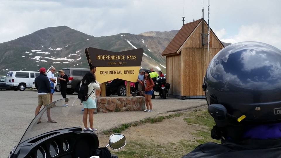
For the sake of establishing an elevation, I think 8500 feet is the marker. I didn’t stay at a Holiday Inn Express or anything, it’s just my guesstimation based upon where we were. When we passed the turnoff to Hwy 82, the way to Independence Pass, we were in the thick of clumps of color.


We made it to Leadville, and so far we had been lucky with the weather, but we began to think wet and cold were unavoidable.


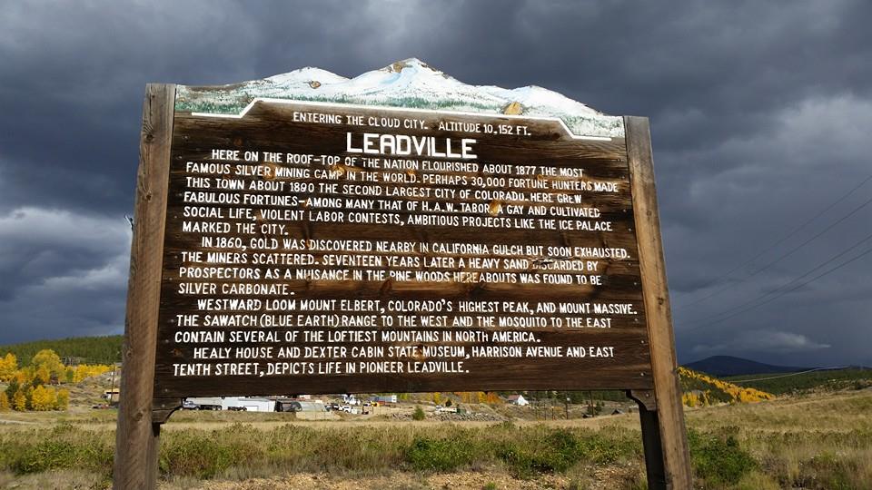

Leaving Leadville, we knew the rest of the way would be high on the viewership scale. It’s an amazing ride during normal times, and since the colors were everywhere, we knew we wouldn’t be disappointed.


A little up the road was a small town called Redcliff. If you look to the left of the bridge, there’s a road that leads down into the valley on the other side where you cannot see. The road you see at the bottom of the picture also goes to Redcliff.


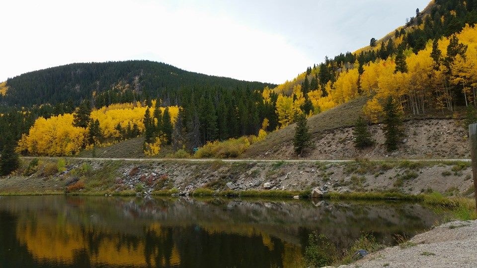
Not more than two miles up the road is Gilman, the abandoned mining town I wrote about earlier in the year, shut down by the EPA back in 1984. It may be polluted with toxic pollutants, but it provides a nice backdrop for color.


We stayed the night in Vail, which is predominately on the south side of I-70. It was sparsely populated due to the off season between summer and ski season.
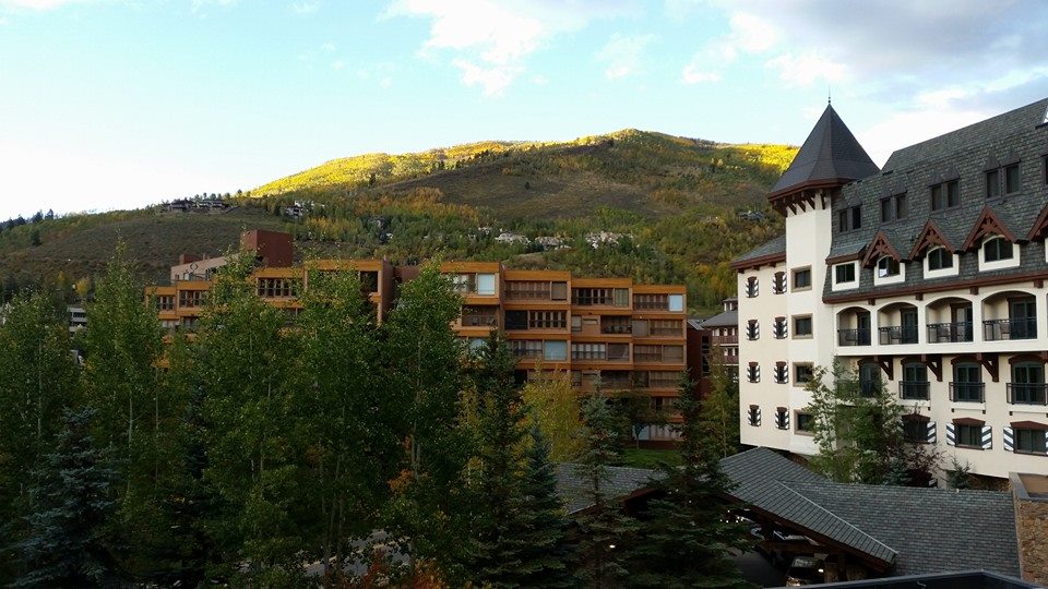


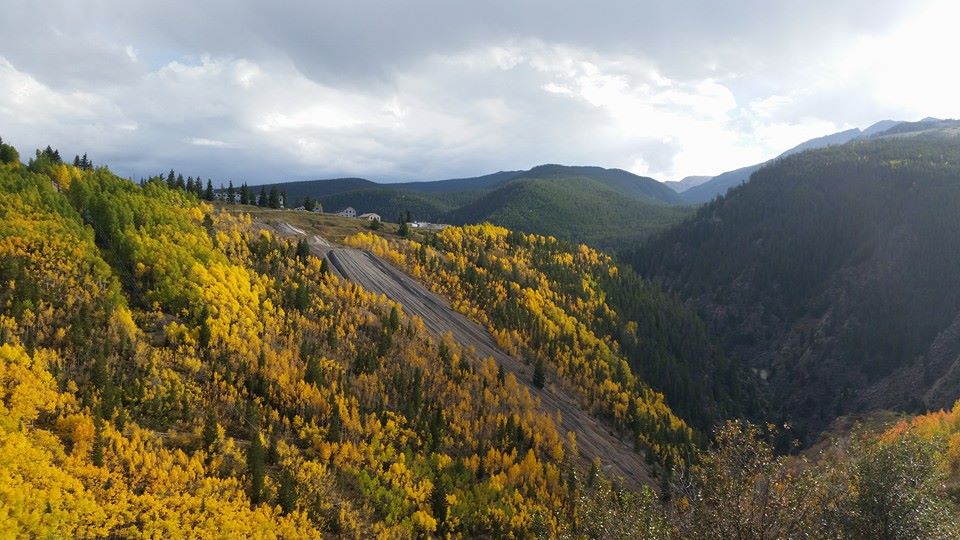
By the way, we made it to Vail without encountering a drop of rain. And that mountain behind us with the golden hue, those are all aspen trees that have already turned.
Up the next morning, it was cloudy and cool. Initial thoughts, our luck had run out. We jumped on I-70 and headed east for Silverthorne and exited to catch Hwy 9. More amazing colors and scenes to be seen, but no pictures due to wanting to evade the weather (cold and mist). We rode Hwy 9 south to and through Breckenridge. Although slow, I don’t think Breckenridge ever looks completely dead.
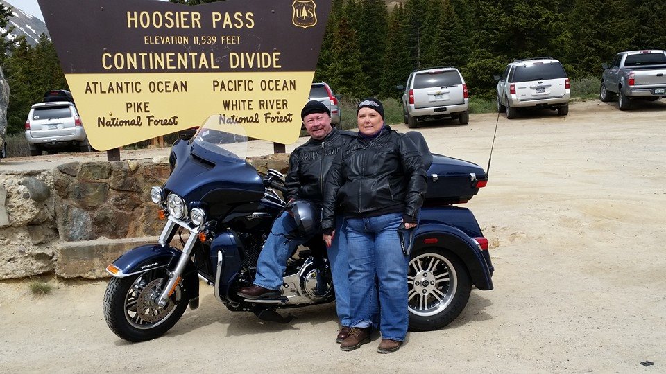
From Breckenridge, we climbed, and by climbed, I mean a good 2,500 feet or more. The air was damp and misty, and the temperature in the 30s. Unfortunately, there isn’t a heater on the Hog…yet. Cresting the summit (11,539 feet), we passed Hoosier Pass. Today was not the day to stop for a photo, a belief shared by many since no one was there when we made our way by. Instead, we continued on to Fairplay where we got a cup of coffee.
From Fairplay, we were about 45 minutes from home, or at least Colorado Springs. We made a few more stops for photos, and it was a good thing. From Woodland Park on east, the colors have yet to turn, but they’re close, really close.
I’m happy to say that we did not encounter rain, which is incredibly amazing due to all of the clouds we encountered. A little mist was all we got, and for this I am thankful. We experienced temperatures from 90 degrees in Canon City to something in the 30s by Hoosier Pass. The fall colors were amazing, and I wish my photos did them some justice.
If you’re in Colorado and haven’t been out to see the colors, your time is running out. The high country is easily 85% turned. From those we spoke to in Vail, everything is 2-3 weeks ahead of schedule. The Farmers Almanac says we are in for a cold and snowy winter. Judging by the colors, it could be early.
Hopefully this isn’t the last ride of the year.
Winter is coming….
Until next time, cheers.
PS. You can click on the photos to enlarge.